Fail:Un-mali.png
Originaline fail (3092 × 2367 piksel'ad, failan suruz': 2,11 mb, MIME-tip: image/png)
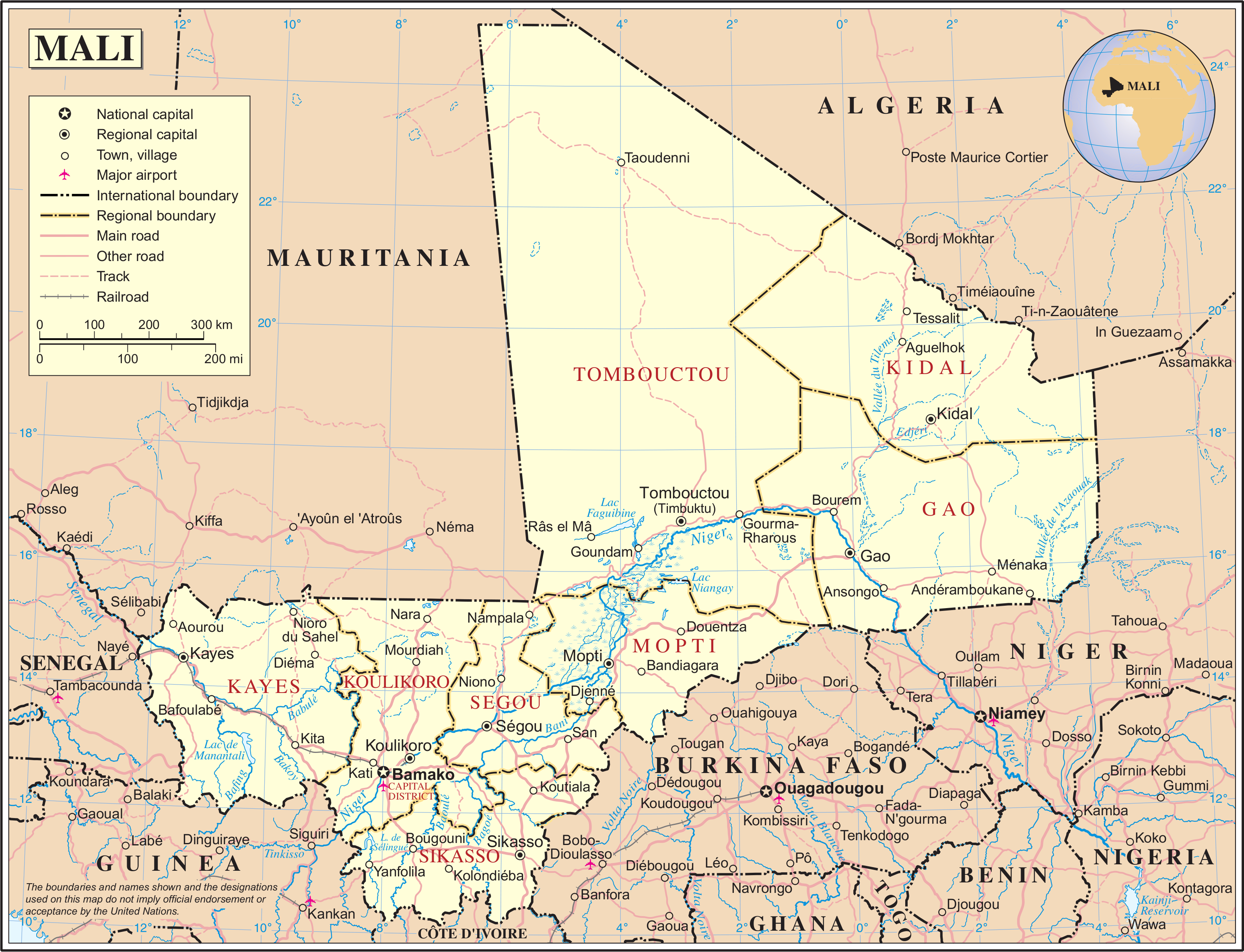
| This image is a map derived from a United Nations map.
Unless stated otherwise, UN maps are to be considered in the public domain. This applies worldwide. UN maps are, in principle, open source material and you can use them in your work or for making your own map. UN requests however that you delete the UN name, logo and reference number upon any modification to the map. Content of your map will be your responsibility. You can state in your publication, if you wish, something like: based on UN map … (map name, map number, revision number and date). See: Geospatial Information Section. And: Geospatial, location data for a better world. |
 |
Failan istorii
Paina päiväle/aigale, miše nägištada, mitte fail oli sil aigal.
| Päiv/Aig | Kuvaine | Suruded | Kävutai | Kirjutez | |
|---|---|---|---|---|---|
| nügüdläine | 24. Reduku 2007, kell 04:31 | | 3092 × 2367 (2,11 mb) | Jeroen | {{UN map}} Category:Maps of Mali |
Failan kävutamine
Ei ole lehtpolid, miččil om nece fail.
Failan leved kävutamine
Nene toižed wiki-lehtpoled kävutaba necidä failad:
- Kävutamine de.wikipedia.org
- Kävutamine el.wikipedia.org
- Kävutamine en.wikipedia.org
- Kävutamine eu.wikipedia.org
- Kävutamine fa.wikipedia.org
- Kävutamine fi.wikipedia.org
- Kävutamine fr.wikipedia.org
- Kävutamine hu.wikipedia.org
- Kävutamine it.wikipedia.org
- Kävutamine lfn.wikipedia.org
- Kävutamine mdf.wikipedia.org
- Kävutamine nl.wikipedia.org
- Kävutamine pl.wiktionary.org
- Kävutamine sw.wikipedia.org
- Kävutamine tl.wikipedia.org
- Kävutamine uk.wikipedia.org
- Kävutamine vi.wikipedia.org
- Kävutamine www.wikidata.org